Home
HILLSBOROUGH COMMUNITY COLLEGE DIGITAL LIBRARY
User account menu
  • Log in

Breadcrumb

  1. Home
  2. Root
  3. HCC Digital Collections
  4. Community Collections
  5. Southern Hillsborough County History

Apollo Beach Collection

Description
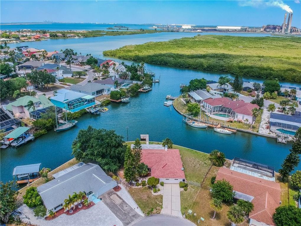
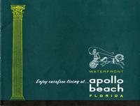
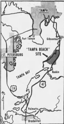
The 5,500 acres tract of land that was to be known as Apollo Beach was first deeded to Paul Dickman in 1920 and used annually for farming and grazing pasture and considered uninhabitable. In the early 1950s, Dickman negotiated the sale of the land to three men from New York: Turner, Dean, and Clark. They renamed the land “Tampa Beach” and construction began on the Flamingo Canal near U.S. 41 and proceeded to Fairway Blvd. In 1957, Francis Corr purchased the land from the N.Y. businessmen who ran out of money. Corr decided the area should be called “La Vida Beach”. Supposedly, in 1958, Corr’s wife Dorothy suggested a new name “Apollo Beach”. This was for the area’s greatest benefit – sunshine. Today Apollo Beach is a thriving waterfront community with year-round boating, fishing, and other water activities. The Big Bend Power Station provides power to the Tampa Bay Area and warm waters that attract manatees and sting rays. The Big Bend Power Station and Manatee Viewing Center are both notable landmarks of Apollo Beach.
Language
eng
Displaying 1 - 6 of 6

Apollo Beach Photo Collection

Apollo Beach Photo Collection
Type: Unspecified
Member of: Apollo Beach Collection
Description: Historical photos of Apollo Beach

Apollo Beach - Miscellaneous

Apollo Beach - Miscellaneous
Type: Unspecified
Member of: Apollo Beach Collection
Description: Items relating to Apollo Beach not otherwise classified. Includes materials used in the marketing of Apollo Beach.

Apollo Beach History

Apollo Beach History
Type: Unspecified
Member of: Apollo Beach Collection
Description: Collection contains items related to the history of Apollo Beach, including it's creation more

Apollo Beach Subdivision Plan Unit 1, Part 1 - 1958

hccfl_1725-Thumbnail Image.png
Type: Still Image
Year: 1958, 1958
Member of: Apollo Beach Collection, Apollo Beach Subdivision Plat Maps: 1958-1959
Description: Initial Subdivision Plan for first section of Apollo Beach from developer Francis Corr. Filed in June, 1958. This section of land is bound by the Flamingo Canal on the north, and Miller Mac Road on the south. This is generally known as the "F Streets" plan, as all of the street names begin with the letter "F". The single exception is Central Boulevard. The original… more
Full Text: http://rightsstatements.org/vocab/NoC-US/1.0/ …

Apollo Beach Subdivision Plan Unit 1, Part 2 - 1958

hccfl_1726-Thumbnail Image.png
Type: Still Image
Member of: Apollo Beach Collection, Apollo Beach Subdivision Plat Maps: 1958-1959
Description: This subdivision plan was the second developed site by Francis Corr, although was offered in the original sale in 1958. This record can be found in the Hillsborough County Clerk's Office is Subdivision Book #34, Page 41 and ff. more
Full Text: http://rightsstatements.org/vocab/NoC-US/1.0/ …

Apollo Beach Subdivision Plan Unit 2 - 1959

Apollo Beach Subdivision Plan Unit 2 - 1959
Type: Still Image
Year: 1959, 1959
Member of: Apollo Beach Collection, Apollo Beach Subdivision Plat Maps: 1958-1959
Description: This is the third section (labeled as Unit 2) in the Francis Corr development of Apollo Beach. This subdivision plat, approved in 1959, is on file at the Hillsborough County Clerk's Office in Subdivision Book #35, Page 41. more
Full Text: http://rightsstatements.org/vocab/NoC-US/1.0/ …
Displaying 1 - 6 of 6

Results per page

  • 15
  • 60
  • 120
  •  List
  •  Grid

Search within Collection

Resource Type

  • Still Image (3)
  • Unspecified (3)

Creators and Contributors

Publisher

Physical Form

Subject

Subject (name)

Temporal Subject

Year

  • 1958 (1)
  • 1959 (1)
RSS feed

  This service is a partnership between Florida Virtual Campus,  Library Services and  
Hillsborough Community College. Privacy Statement. All Rights Reserved.
At present, our website is still a work in progress as we continue the archival process of thousands of items.  Our artifact display and research area is currently located inside the Learning Resource Center at the SouthShore Campus and has the same hours as the library.